See the map before you buy, build, or plan.

Zavia GIS turns public environmental and land-use data into clear maps and desktop screening reports — so you spot floodplains, wetlands, conservation areas and other mapped constraints before they cost you tens of thousands.

2–3 day turnaround · Launch pricing from $249 · Public-data based
Layered GIS map of property constraints
Z
$40,000 renegotiated before closing. A client used Zavia’s mapped findings — 2.4 of 5 acres flagged inside a wetland buffer — to renegotiate the price before closing.

Most properties look simple — until the map says otherwise.

Floodplains, wetlands, watercourses, woodlands, regulated areas, natural heritage features, zoning overlays. A property can look fine on a listing and still carry constraints that affect your offer, your design, your permit timeline, or your build cost.

Zavia GIS reads the public maps before you commit — and gives you a clear, plain-English report so you can ask better questions earlier.

A $249 screening helped one client identify a mapped wetland buffer affecting 2.4 of 5 acres before closing — information they used to renegotiate $40,000 off the price.

Property types where mapped constraints most often matter.

Zavia screening pays off the most when a property has any of these characteristics. If you see your property in the list — send us the address.

Vacant land
Rural / semi-rural lots
Ravine lots
Creekside properties
Properties near wetlands
Properties near woodlands
Custom home lots
Small development parcels
Near Conservation Authority regulated areas
Near floodplain mapping
Natural heritage features
Infill lots near watercourses
Introductory Launch Pricing

Four focused services. Productized, priced, and scoped.

Reduced launch pricing while we build our Ontario portfolio. Pricing may increase as service demand grows.

01

Property Environmental Screening

A fast desktop GIS review for simple properties — an early look at mapped environmental and planning-related constraints before making an offer.

  • Property context & constraint map
  • Floodplain, wetland & watercourse review
  • Suggested next questions
Launch — from $2492–3 business days

Expected regular pricing: from $395.

02

Standard Property Screening Report

A more detailed package with additional map views, source references, and suggested next questions for the municipality, conservation authority, or planner.

  • Multiple map exhibits
  • Data references & source list
  • Follow-up questions to ask
Launch — from $3953–5 business days

Expected regular pricing: from $495–$595.

03

Development Constraint Mapping

For builders, small developers, architects, and planning consultants. A detailed map package before design, purchase, or permit review.

  • Constraint overlays & buffers
  • Parcel + site context maps
  • Exportable PDF + optional KMZ / QGIS
Launch — from $4993–5 business days

Expected regular pricing: from $795.

04

GIS Mapping for Consultants

Report-ready figures, buffers, KMZ / QGIS deliverables, and overflow GIS support for environmental consultants, planners, arborists, and engineers.

  • Report figures & exhibits
  • Excel-to-map conversion
  • Field-data & revision support
From $75/houror fixed-fee project pricing

Scope-based. NDA available on request.

From property address to clear report in three steps.

STEP 01

Send the property address

Share the address, parcel, or project location. Tell us the purpose of the review and your timeline.

STEP 02

We review public GIS data

Relevant mapped environmental, hazard, planning, and site-context layers are reviewed and organized.

STEP 03

You get clear maps & notes

A PDF package with maps, screening notes, data sources, and suggested next questions.

Zavia GIS process workflow visualization
PDF

7 Mapped Constraints
to Check Before Buying
Land in the GTA

Free checklist · 5-minute read

7 mapped constraints to check before buying land.

Before you waive conditions or spend money on consultants, use this checklist to understand the public map layers that often matter most: floodplains, wetlands, woodlands, watercourses, regulated areas, natural heritage features, and zoning / plan-area overlays.

Plain-English. Built around real GTA findings. Tells you what to look for on the public maps — and what each flag actually means.

No spam. Just the checklist and occasional practical property-screening notes — unsubscribe any time.

See what a screening report actually contains.

Browse sample maps and a downloadable PDF report. Each sample is built around public GIS data using the same workflow as a live engagement.

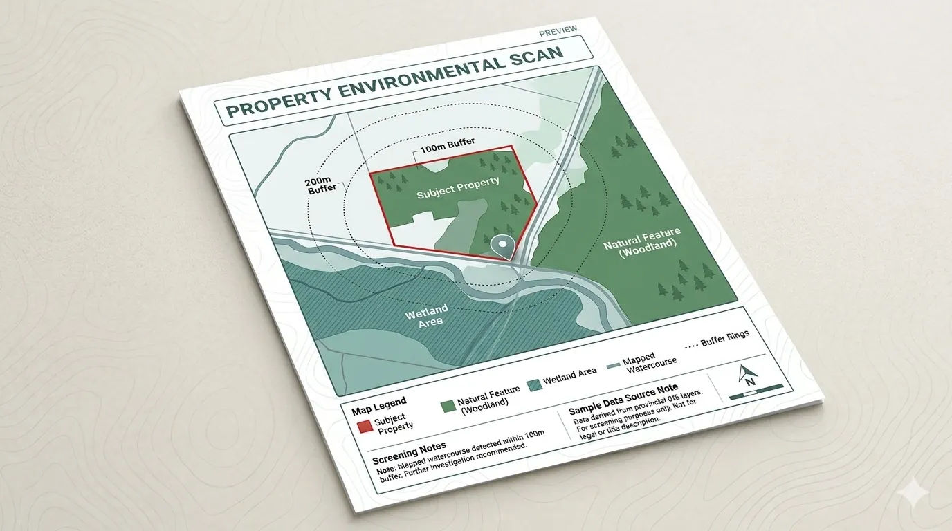
Sample property environmental scan

Property Environmental Scan

Subject property, nearby natural features, watercourse context, buffer rings, legend & screening notes.

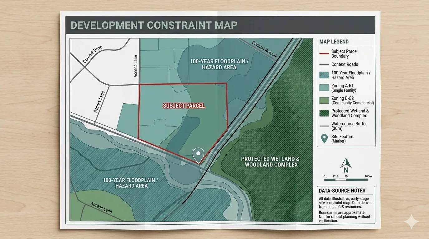
Sample development constraint map

Development Constraint Map

Parcel boundary, hazard overlays, protected natural areas, context roads, scale bar & data sources.

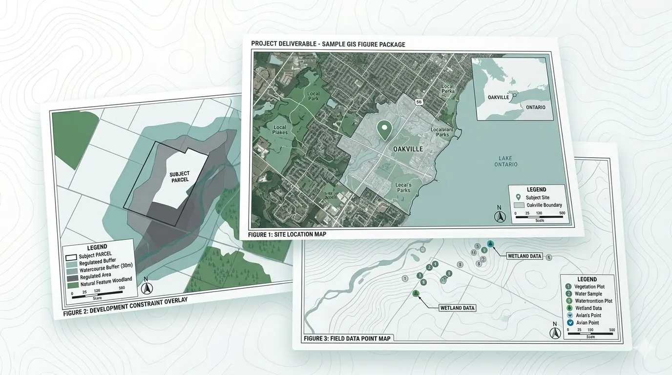
Consultant GIS figure package

Consultant GIS Package

Multiple report-ready figures: site location map, constraint overlay, field data point map.

Quick answers before you reach out.

Is this a formal Environmental Site Assessment?

No. Zavia GIS provides preliminary desktop screening and GIS mapping support using public data. It does not replace a Phase I/II ESA or professional regulatory review.

Can you tell me if I can build on the property?

No. Zavia GIS does not provide buildable / not-buildable conclusions. We help identify mapped constraints and suggest questions to ask the relevant authority or qualified professional.

What do you need to start?

A property address, parcel number if available, listing link if available, and a short note on what you're trying to do.

How fast can I get a report?

Simple property scans typically take 2–3 business days. More complex map packages may take 3–5 business days.

Is Zavia GIS the right fit for you?

We are deliberately scoped — the more honest we are about what we do and don’t do, the better the work we deliver.

This service is for you if…

  • You are considering buying a property and want a map-based reality check before making an offer
  • You are a realtor helping a client ask better questions before they waive conditions
  • You are a homeowner planning early improvements, custom build, or severance
  • You are a small builder or designer needing early GIS mapping before design
  • You are an environmental, planning, or engineering consultant who needs clean overflow GIS mapping support

This service is not for you if…

  • You need a formal Phase I or Phase II Environmental Site Assessment
  • You need legal, engineering, planning, or surveying advice
  • You need a permit, planning approval, or Conservation Authority sign-off
  • You need a formal confirmation that a property is buildable
  • You need regulatory sign-off or a stamped report

For any of the above, we will tell you honestly and recommend the right type of qualified professional to escalate to.

A smarter first step — not a replacement for formal consultants.

Zavia GIS is designed for early-stage decisions. If the screening identifies potential concerns, the next step may be to speak with the relevant municipality, Conservation Authority, planner, surveyor, engineer, or environmental consultant.

Questions a Zavia screening helps you ask

Is the property near or inside a Conservation Authority regulated area?

Is there a mapped wetland, woodland, watercourse, or floodplain nearby?

Should I contact the municipality or Conservation Authority before waiving conditions?

Do I need to speak with a planner, surveyor, engineer, lawyer, or environmental consultant?

Are there mapped constraints that may affect future plans for a renovation, severance, or custom build?

We tell you what to ask and who to ask it to — before you spend more.

Send us a property address.

Tell us what you're trying to do. We'll recommend the right screening package and confirm pricing within one business day.

Send a property address →Start